Energy transition
RPS delivers BOEM report on potential hazards for the US Offshore Pacific Wind Farms
RPS recently completed a study for the Bureau of Ocean Energy Management (BOEM) titled “Potential earthquake, landslide, tsunami and geo-hazards for the US Offshore Pacific Wind Farms”.
For the study, RPS analysed publicly available datasets of the geological and geophysical seabed and soil conditions, ground acceleration and bathymetry slope. Using the data and suitability analysis models, we created suitability maps of the areas of interest for Oregon, California Humboldt, California Morro Bay and Diablo Canyon, Hawaii Oahu North and Hawaii Oahu South lease sites. We delivered a deeper understanding of geo-hazards and how they might affect the performance of floating offshore wind farms and reduced the complexity of selecting potentially suitable lease sites.
Location of floating windfarms
Deployment in tectonically active regions increases the risk of potential geohazards for floating offshore wind farms off the US Pacific Coast. The design of the turbines installed in earthquake-prone regions must consider:
- The fault conditions relevant to the electrical system
- The soil condition at the sites and its liquefaction or mud failure
- The loads imposed on the mooring and anchorage system and buried cables due to seismic activity, hydrodynamic added mass and tsunami waves

Natural geo-hazards in the region must be assessed, and soil types identified, prior to selecting suitable sites. Site-specific characterisations need to be conducted, and data on seafloor characteristics need to be collected to identify site-specific hazards for project components such as mooring and underwater transmission, based on the ground type reaction to earthquakes and potential bathymetric changes due to landslide.
Related read: discover more about Research & Development for renewables at RPS
Services we provided
Desktop study
We provided guidance by identifying the best current practices regarding the geological hazards posing risks to components of floating offshore wind farms.
Literature review
We presented a literature review on approaches and standards applicable to the siting and engineering processes associated with floating offshore structures. The geo-hazards off the US West Coast and Hawaii that may directly or indirectly affect floating offshore wind farm were assessed to determine which potential geological hazards could impact the siting of floating offshore wind farms and pose risks to the mooring and anchorage systems and buried cables.
Geospatial indexing
We analysed publicly available datasets, in the form of geospatial raster maps, describing seabed and soil conditions, ground acceleration and bathymetry slope in the region . The datasets were then weighted and overlaid to determine the suitability of the area and consider the risk for installation of floating offshore wind.
Website development and data management
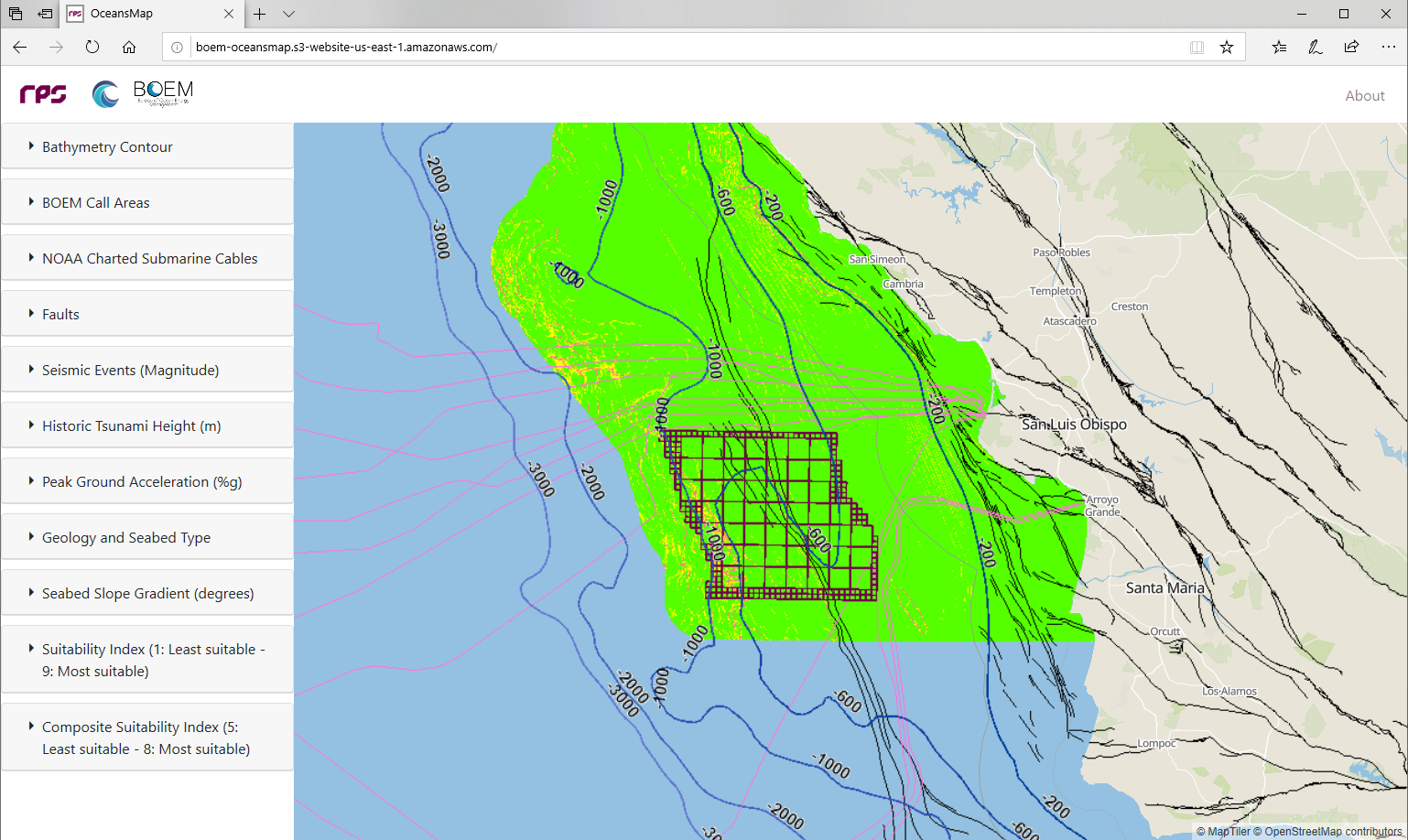
Maps and geospatial data analysed for the project and the suitability outputs are available online through an interactive web map interface.
Results
This study identifies:
- The challenges and critical needs for design and installation of floating offshore wind turbines in regions with geo-hazards
- How the existing standards can be applied
- Where the regulations and standards need to be improved
- What site-specific analyses are needed
To incorporate each of the variable inputs of soil type, bathymetry slope and earthquakes, and apply them to the suitable site location selection problem, the data are classified to common scales and overlaid using assigned weights. The weighted overlaid maps show the suitability of the region by using the total value of all weighted layers and allows for an understanding of the importance of each variable in finding the best site location.
This was a complex challenge that was made easy to understand through interactive maps with geospatial indexing of the suitability of the regions, accessible through an interactive map interface. The methodology can be used and replicated around the world for other areas with potential geo-hazards, e.g. Japan and East Asia.
Visit the interactive website
Visualize and interact with the data, live on the website developed by RPS for the Bureau of Ocean Energy Management.
Visit BOEM OceansMap


