

Surveying
As cities grow and land uses evolve, reliable spatial data is pivotal to the effective design and management of built and natural environments. Our surveying services can capture, interpret and present smart spatial information you can rely on, to prevent even the smallest errors at the beginning of a project that could have a major impact on design and delivery down the line.
What we do
At RPS, we deliver a comprehensive range of onshore and offshore surveying services, playing a vital role in supporting some of the most prestigious development projects around the world.

Spatial information you can rely on
Using state-of-the-art technologies, we help architects, engineers and contractors to understand their operational environment, design with confidence, and deliver projects on time and on budget.
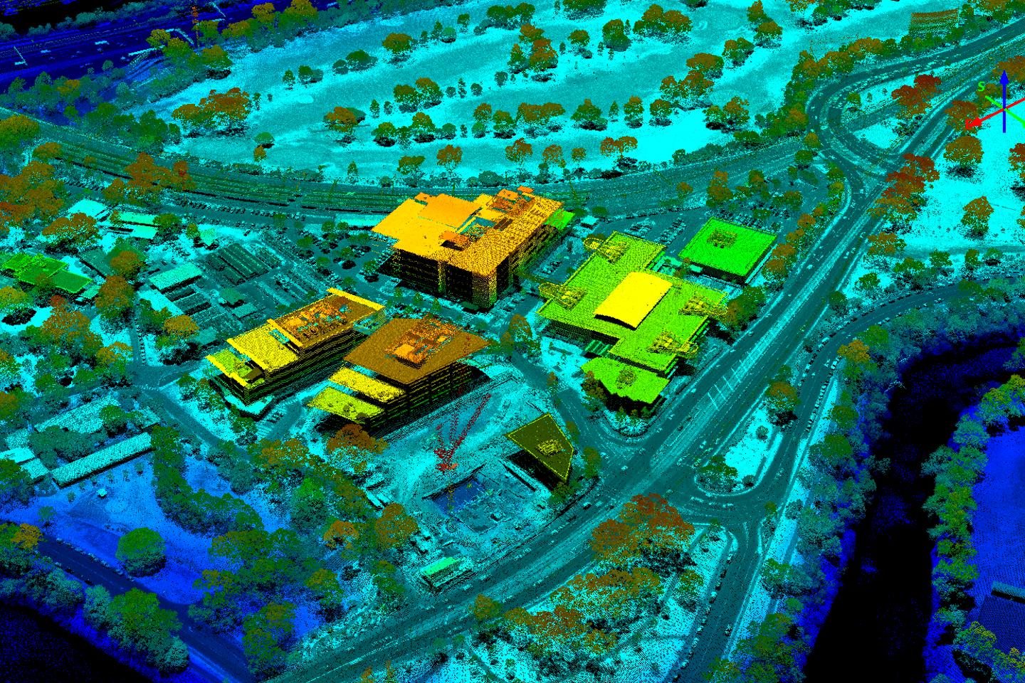
From minutely accurate point cloud models that help streamline the design process and avoid costly clashes for architects, to hydrographic surveys that help offshore operators understand the topography of the ocean floor, our surveyors and mapping specialists can customise a spatial solution to fit your unique project requirements, systems and stakeholders.

Our surveying services
Land surveying: surveying and titling for land and buildings including subdivision, strata and stratum/volumetric survey
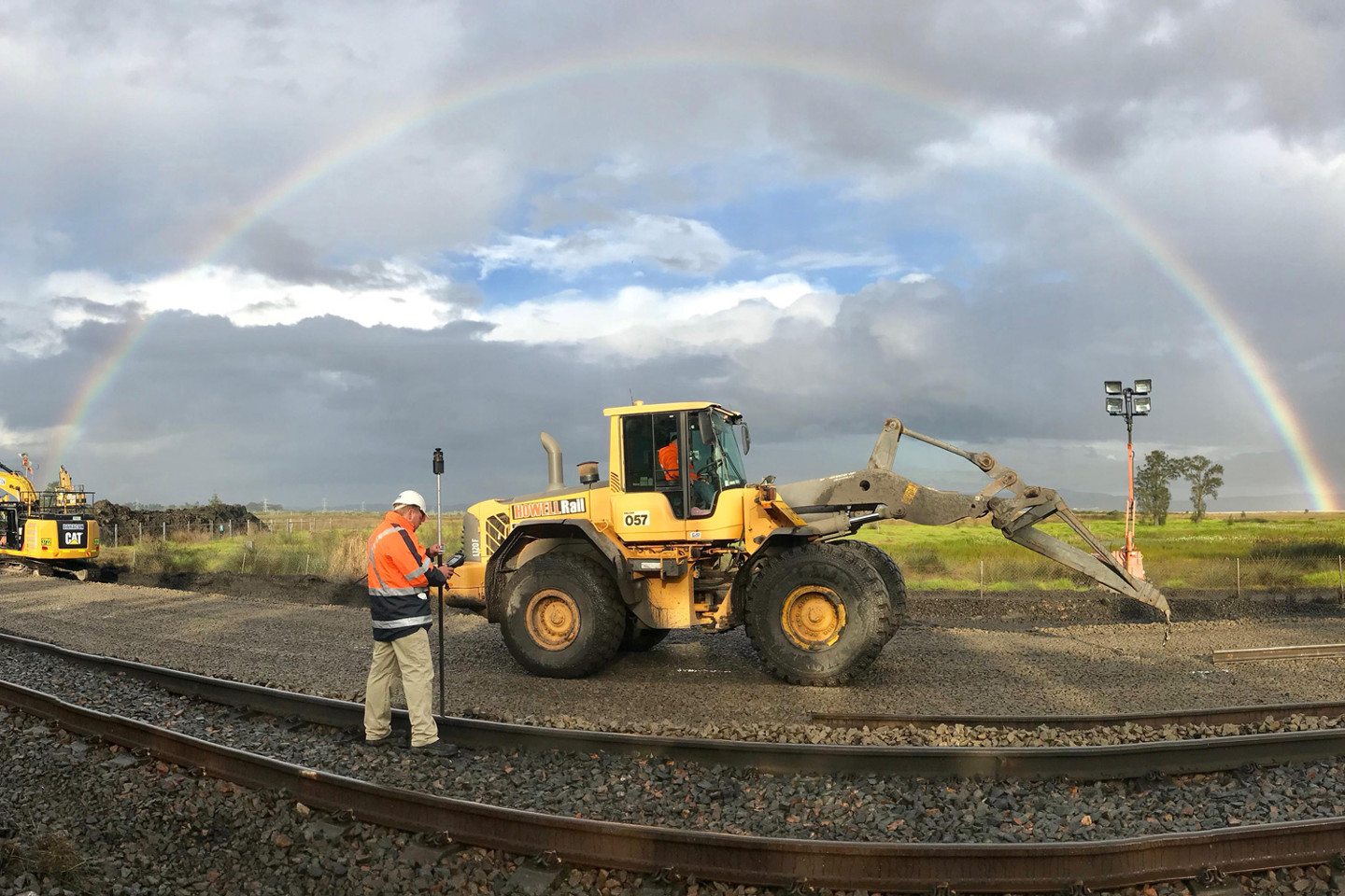
Infrastructure surveying: topographical survey, construction set-out and as built and survey control
Services and utilities: location and mapping of underground pipes and cables, heritage investigations, ground penetrating radar (GPR)
Measured building surveys: floor plans, area referencing, elevations, cross sections, roof plans and ceiling plans
Unexploded ordnance (UXO): explosive remnants of war (ERW) assessment and remediation covering land and water
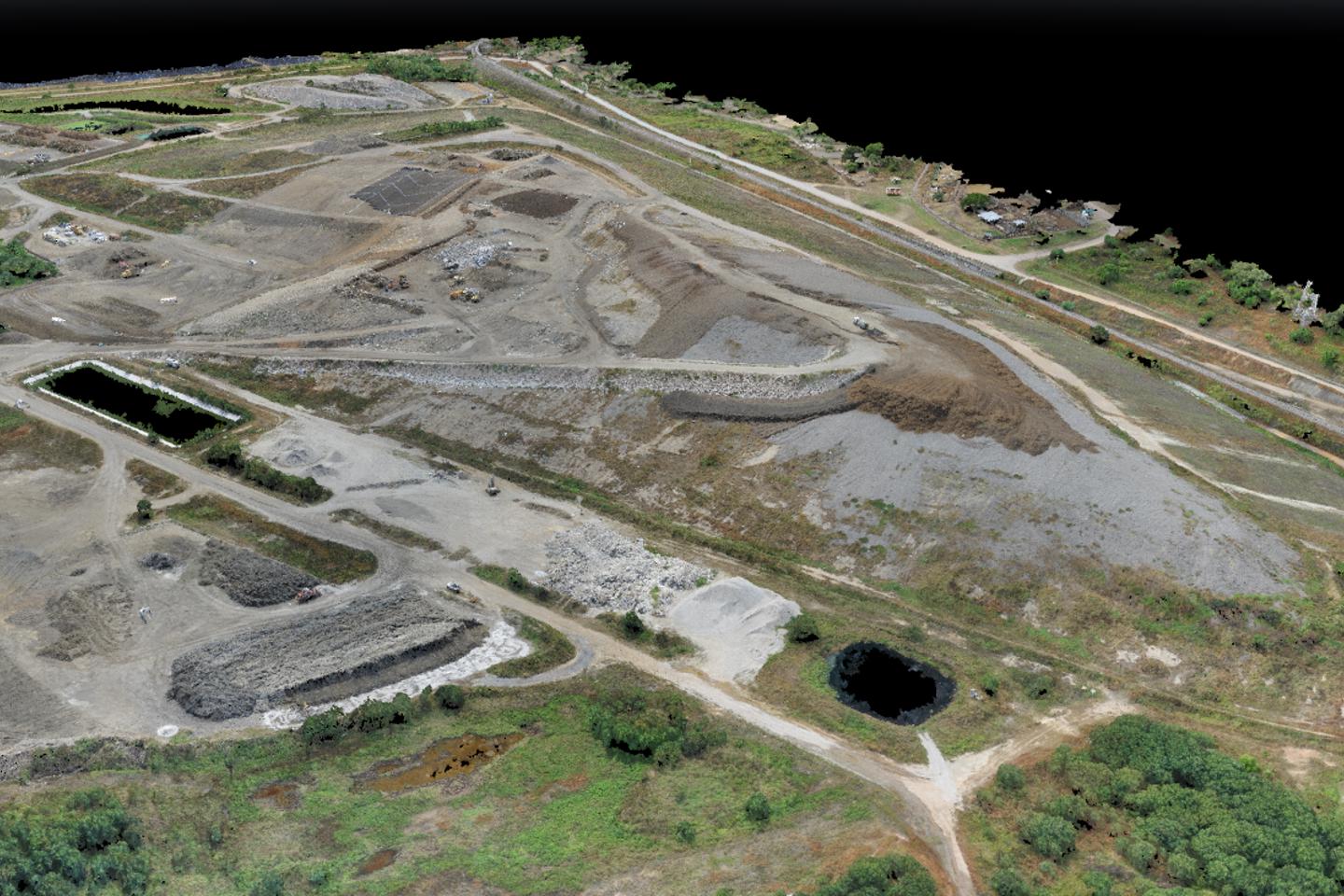
Data capture and processing: aerial and terrestrial surveys utilising light detection and ranging (LiDAR), laser scanning, drones, GIS and 3D modelling
Hydrographic survey: hydrographic investigations including bathymetric survey, seafloor topography and depth mapping
Remotely piloted aircraft (RPA) surveys: capture of photogrammetric, video imagery for asset inspections, LiDAR, thermal, multispectral and gas emission data for use in multiple industries supported by a large fleet of RPAs and certified pilots in key geographical locations throughout Australia.
Services visualised
Whether you are planning a new construction project, seeking to define property boundaries, or require detailed topographical information, our team of experienced surveyors can deliver comprehensive surveying services. Utilising innovative technology and a wealth of knowledge, we ensure precise measurements and reliable data that can support your project at every stage from its inception to its completion.
At RPS, we provide the insights and expertise you require for informed decision-making and a successful outcome.


Contact us
Related expertise

Related services


RPS shapes places with heart
For decades, RPS has been shaping liveable communities. Our award-winning multi-disciplinary team leverages global experience to transform both small corners and grand icons, designing spaces that pulse with life.
