SARMAP
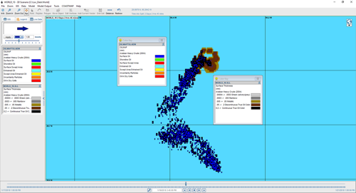
SARMAP is a search and rescue model system that provides rapid predictions of the movement of drifting objects and missing persons in marine and aeronautical environments.
No Content Set
Exception:
Website.Models.ViewModels.Components.General.Banners.BannerComponentVm

Includes algorithms for spreading, evaporation, emulsification, entrainment, oilshoreline, oil-reed bed, and oil-ice interaction.
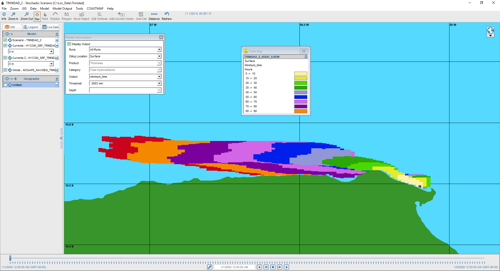
Surface and subsurface oil movement can be animated to identify shoreline impacts.
Outputs graphical and tabular listings of weathering mass balance results, and display of GIS resources impacted by the spill.
Includes simple graphical procedures for specifying the spill scenario and entering both wind and hydrodynamic data.
At RPS, we understand the critical importance of effective oil spill response and management. That's why we have developed RPS OilMap, a cutting-edge software solution designed to assist oil spill responders, environmental agencies, and industry professionals in accurately modeling, simulating, and mitigating the impact of oil spills on marine and coastal environments.
Far-field model for surface and subsurface releases that predicts the 3D trajectory and fate of oil for instantaneous or continuous release spills.
Used for risk assessment and contingency planning. Helps determine most likely spill paths and minimum time on monthly, seasonal, or annual basis
At RPS, we understand the critical importance of effective oil spill response and management. Check out our supporting software.
Please click on the button below to access: your software user account information; application updates; and support documentation.
At RPS, we are committed to empowering organizations with advanced tools to enhance oil spill response and minimize environmental impacts. Contact us today to request a demo or to learn more about how RPS OilMap can revolutionize your oil spill modeling and response capabilities.


Director, International Services