-

Accurate, reliable, readily available data
10-minute averaged wind data is transmitted near real-time and raw data is transmitted daily. The buoy features a ZX 300M LiDAR sensor, whose reliability has been proven by multiple deployments across the globe.
-

Quality data assured
LiDAR status is monitored through real-time sensor monitoring with automated data quality control and regular manual quality assurance.
-

Uses renewable power
Solar panels and micro-turbines harness energy to recharge internal batteries – helping meet the stringent environmental consenting conditions often associated with renewable wind farm projects.
-

Special mooring design
Enables accurate wave measurement. Ensures buoy doesn't pull through wave crests in storm conditions. Reduces risk of entanglement for marine life.
-

Redundancy features
Two independent power systems – can run for 12 days without charging from sun or wind. Redundant satellite, WiFi and 4G communication devices to suit any communication requirement.

Floating LiDAR buoy
Data certainty. Trusted globally.
For developers, competition is increasing as the search widens for cleaner, renewable energy resources offshore. Collecting reliable data that supports a ‘bankable investment’ narrative is critical.
We took traditional LiDAR technology and integrated it into a floating buoy with highly reliable renewable power, data storage and satellite communication capabilities. We gather and deliver accurate data your project can trust.
Checklist: how to select the right Floating LiDAR buoy
They're an essential tool for gathering wind resource and other metocean data, but if you're researching which buoy to choose, how do you ensure you'll get value from your investment? For some suggestions, sign up to receive our list of key questions to ask.

Our design and development process applies our deep expertise of offshore measurement. The resulting design makes the process of information gathering easier and more cost-effective for our clients.
RPS’ floating LiDAR is environmentally friendly. Our mooring design minimises seabed damage and risk of marine life entanglement. The buoy is powered by solar and wind energy, helping meet the stringent environmental consenting conditions often associated with renewable wind farm projects.
It’s robust too – when two buoys deployed in 220m of water off South Korea took a direct hit from Typhoon Maysak in September 2020 (estimated to be an extreme, 50-year return period, storm event), our buoys continued to transmit data. We now have a detailed data set that will inform critical design elements for our clients.
Related read: discover more about Research & Development for renewables at RPS

Making complex easy - the RPS Floating LiDAR buoy
Traditional LiDAR technology in a buoy – with power, data storage and satellite communication capabilities.
(Video running time: 90 seconds.)

RPS Floating LiDAR buoy key features


Stage 3 maturity
The Carbon Trust roadmap outlines a strategy to ensure the commercial reliability and acceptability of floating LiDAR data technology. To this end, they have designed a robust certification process.
In early 2024, our floating LiDAR technology achieved Stage 3 certification, having collected sufficient high-quality data through extensive campaigns globally since 2018. This qualifies them as fully commercial for the collection of bankable data at the highest level of buoy reliability and accuracy. Stage 3 is the highest level of accreditation, reflecting increasing certainty in the data collected.

Outstanding safety credentials
RPS has maintained a strong safety record, including winning multiple safety awards. Click below to read more.

Let’s hear it for the buoys: why RPS floating LiDAR is a long-running success
RPS’ floating LiDAR buoys offer world-leading measurement technology. Their reliability means that our clients can expect successful acquisition of high value continuous data, delivered on time.
The buoys’ success is down to excellent build quality, our team’s decades of metocean experience and their advanced design, including remote intervention capabilities.

Managing project development risk through design
When gathering design and feasibility data for offshore wind projects, which challenges are deal-breakers for you? Find out how the RPS Floating LiDAR buoy's advanced design mitigates against some common project risks.
(Video running time: 1 minute)

Recent deployments - key markets
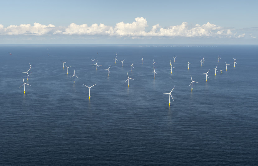
RPS’ floating LiDAR buoys provide highly accurate data to inform offshore wind farm development, for activities such as site selection, yield optimisation, array engineering and workplace safety. They have so far been deployed in the US, the UK, Europe, Australia and South Korea.
The power system of our buoy is designed to support high or low latitude deployment, except for regions where sea ice is prevalent. The buoy and mooring system are tailored for each deployment and for the water depth and extreme environmental conditions expected, including typhoons, hurricanes and cyclones. The buoy can be deployed in water depths ranging from 10m to full ocean depth.
Read some of our more recent case studies
-

Innovation: we're asking "What else can we put on a LiDAR buoy?"
While supporting our client RVO in the Netherlands, we've also been looking at ways we can innovate to further support offshore development.
Read the case study -

RPS LiDAR buoy records extreme conditions during 2022 winter storms
Data like this is vital to our clients. In the Northeast US, an RPS buoy gathered data during max. wind speed up to 30 m/s and wave heights up to 10 metres. A second storm featured blizzard conditions, similar wind speeds and temperatures below -5°C.
-

Equinor and RPS successfully launch LiDAR buoys, South Korea
Equinor plans to develop the floating offshore wind project Firefly. RPS was engaged to deliver two Floating LiDAR buoys to collect data that will determine future investment decisions.
-

Supporting Equinor off the U.S. Atlantic coast
Combining world-leading floating LiDAR measurement technology with advanced metocean data analysis and modelling capability, our team is monitoring a range of open ocean environmental variables.
-

Delivering a metocean survey programme for the Beacon Wind Energy Area, U.S.
RPS has been delivering oceanographic data for Equinor across the New York Wind Energy Area. We will also deliver wind, wave and current monitoring with real-time data transmission for a 24-month measurement programme in Massachusetts.


Insight: Achieving wind measurement success offshore
Traditional LiDAR is used extensively for mapping the spatial characteristics of built and natural features on land. However, to ensure the commercial viability of an offshore wind farm, our clients need reliable resource data to support their project feasibility assessment. Floating LiDAR technology is the future in terms of collecting trusted resource data to support investment decisions.

Downloads
More questions? Read our Floating LiDAR FAQ sheet.
Key contacts

Murray Burling
Executive Director – Oceans and Environment
Mike Matson
MetOcean Operations Manager

Michael Wiegele
LiDAR Survey Manager